We recently completed a tomography survey near the St. Johns River where a commercial developer kept hitting unexpected limestone pinnacles at 35 feet. Three borings told a fragmented story, but the client needed a continuous profile between them. That is exactly where seismic refraction and reflection methods earn their place. Jacksonville’s subsurface is a mosaic of ancient marine terraces, filled paleochannels, and karstified limestone from the Ocala Group, and relying solely on point data can lead to costly surprises during excavation. We ran a 230-foot refraction line with a 24-geophone spread, and within hours the crew had mapped the undulating rockhead across the entire site. For deeper targets, like mapping the Floridan aquifer confining unit, we switch to reflection acquisition, which gives us structural detail well past 200 feet. The resulting tomogram becomes a conversation tool between the geotechnical engineer, the structural designer, and the contractor, putting everyone on the same page about what’s underground before a shovel hits the ground. When you need to connect the dots between widely spaced test pits or confirm the lateral extent of a soft zone flagged by CPT testing, seismic tomography provides the missing 2D context that point investigations simply cannot deliver.
Seismic tomography converts a handful of borings into a continuous cross-section, revealing the undulating limestone surface that defines Jacksonville’s geotechnical risk profile.
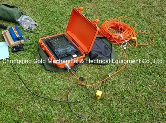
How we work
Jacksonville’s geology changes dramatically within a few miles. Out toward Cecil Field on the western uplands, the Hawthorne Group clays sit close to the surface, creating a strong velocity contrast that makes refraction modeling straightforward and reliable. Head east to the Intracoastal Waterway corridor, and you are dealing with loose quartz sands over a highly irregular limestone surface, often riddled with dissolution cavities that can collapse under footing loads. In our experience, a combined refraction and reflection survey is the most practical way to image both the soil-over-rock transition and any deeper voids that could threaten a pile-supported structure. For a warehouse project in the Arlington area, we integrated the seismic results with
MASW surface wave data to constrain the shear-wave velocity profile above the rock, giving the structural engineer everything needed for a site-specific ASCE 7 ground motion analysis. The key technical advantage of tomography, as opposed to simple delay-time refraction, is that it reconstructs a continuous velocity gradient rather than assuming discrete flat layers. This matters in Jacksonville because the limestone surface is often pinnacled and weathered, not a clean planar boundary. Our processing workflow uses an iterative damped least-squares inversion, and we validate the final model against available boring logs so the interpreted depths are defensible under peer review.
Local geotechnical context
Jacksonville sits just 12 feet above mean sea level, and its stormwater infrastructure faces constant pressure from a shallow water table that often sits within 3 to 5 feet of the surface. Combine that with a limestone formation that has been dissolving for millions of years, and you get one of the most litigated geotechnical environments in Florida: sinkhole claims. A standard SPT boring can miss a 4-foot-wide void by two feet laterally and report competent rock, while a seismic refraction line will flag it as a low-velocity anomaly immediately. We worked on a residential subdivision near the Timucuan Preserve where four homes had settled differentially within the first two years. The builder’s original investigation relied on three borings spaced 150 feet apart. When we overlaid a reflection tomography grid, we mapped a paleosinkhole 60 feet across that the borings had completely straddled. The cost of remediation dwarfed the cost of the seismic survey. For critical infrastructure and high-occupancy structures, the IBC and Florida Building Code permit geophysical methods as a supplement to borings precisely because they reduce the statistical blind spot. In karst terrain like Jacksonville’s, a liquefaction assessment also benefits from knowing where the rock surface is truly competent versus where it is a weathered, soil-filled depression.
Questions and answers
What does a seismic tomography survey cost for a typical Jacksonville commercial lot?
For a standard commercial site in Jacksonville, a refraction tomography survey covering about 500 to 800 linear feet with one or two lines generally runs between US$2,410 and US$5,380. The final number depends on the number of spreads, the source type needed to penetrate the limestone, and whether we are combining refraction with reflection. Sites with heavy surface traffic or dense vegetation that slows down line layout add some logistical cost, but we can usually provide a firm quote after a brief site walk.
How deep can seismic tomography see in Jacksonville’s coastal plain geology?
Refraction depth is controlled by the length of the geophone spread; we typically reach 60 to 100 feet with a 230-foot spread, which is enough to map the limestone surface across most of Duval County. For deeper targets such as the Floridan aquifer confining unit at 150 to 250 feet, we switch to a seismic reflection configuration with a longer offset and a heavier source. The practical limit in our Jacksonville work is about 300 feet, beyond which the signal-to-noise ratio drops sharply in the saturated, attenuating sands.
Can seismic tomography detect sinkholes and cavities before construction?
Yes, and this is one of the most common reasons we are called to sites in Jacksonville. A dissolution cavity in limestone produces a sharp drop in seismic velocity that stands out clearly on a refraction or reflection tomogram, often appearing as a bullseye-shaped anomaly. The method does not detect every tiny void, but features larger than about 2 to 3 feet in diameter are typically resolved when the geophone spacing is tight enough. We always recommend pairing the seismic grid with a targeted boring program so any velocity anomaly can be ground-truthed and, if necessary, grouted or bridged in the foundation design.