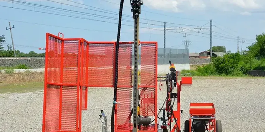
Jacksonville’s coastal geology demands more than a textbook approach to subsurface exploration. The St. Johns River snakes through a city built on layers of Pleistocene sand, marine terrace deposits, and pockets of organic silt that can wreck a foundation schedule if nobody spots them early. At a mean elevation of just 16 feet above sea level, the water table sits barely 4 to 6 feet down across much of Duval County, which turns any boring into a race against sand heave and borehole collapse. We run the Standard Penetration Test under ASTM D1586 because it gives contractors and structural engineers a direct N-value they can plug straight into bearing capacity equations—no guesswork, no extrapolations from a different geology. When a Jacksonville project crosses from the sandy uplands west of I-295 into the marsh-edge clays near the Trout River, the SPT blow count often shifts 20 points in fifty feet, and that’s the kind of contrast you need to catch before steel goes in the ground. For sites where continuous cone data would sharpen the stratigraphic picture, we pair SPT borings with a CPT test to map thin sand seams that can carry water under pressure, and for deeper investigations we run our drill rigs alongside MASW surveys that bracket shear-wave velocity without extra boreholes.
An SPT N-value without a groundwater reading is half a data point—in Jacksonville’s surficial aquifer, the two have to travel together.
Local geotechnical context
Jacksonville’s post-consolidation boom pushed subdivisions into flatwoods and drained wetlands that looked easy on a topo map but carried a hundred years of buried organics. When the 1960s drainage districts dug canals through the Southside, they lowered the regional water table just enough to kick off slow oxidation and settlement of peaty soils under neighborhoods that had already been platted. Today a developer pulling a building permit off Beach Boulevard can find clean SPT N-values of 18 at 6 feet and then watch the spoon drop under its own weight at 12 feet because the rig hit a pocket of decomposed sawgrass. That contrast is exactly why the Florida Building Code references IBC Chapter 18, which requires a sufficient number of borings to characterize stratification before structural design. We log every core run and every spoon sample with enough detail that the geotechnical engineer can draw a cross-section that shows the muck lens, the confining sand layer, and the depth where bearing capacity finally exceeds 2,000 psf. In Jacksonville’s Intracoastal West zone, where storm surge from Hurricane Irma saturated the upper 8 feet of soil for weeks, an SPT campaign done too soon after heavy rain can produce N-values 5 to 8 blows lower than the same soil would yield after drainage—so timing matters as much as drill depth.
Regulatory framework
ASTM D1586-18 (Standard Test Method for Standard Penetration Test and Split-Barrel Sampling of Soils), ASTM D2487-17e1 (Standard Practice for Classification of Soils for Engineering Purposes – Unified Soil Classification System), ASCE 7-22 (Minimum Design Loads and Associated Criteria for Buildings and Other Structures – liquefaction screening), IBC 2021 (International Building Code, Chapter 18 – Soils and Foundations), ASTM D6066-11(2018) (Standard Practice for Determining the Normalized Penetration Resistance of Sands for Evaluation of Liquefaction Potential)
Questions and answers
How much does an SPT boring program cost for a typical Jacksonville residential lot?
For a standard residential lot under half an acre, a two-boring SPT program in Jacksonville generally runs between US$530 and US$870 per boring, depending on depth, access, and whether hollow-stem augering or rotary wash is required. Sites with poor access, dense vegetation, or depths beyond 40 feet will shift toward the upper end.
How deep do SPT borings need to go for a commercial building in Jacksonville?
Florida Building Code requires borings to extend at least 10 feet below the deepest proposed foundation element, or until competent bearing is demonstrated. In Jacksonville’s coastal plain, that often means 30 to 60 feet, especially where Holocene organics or loose sands overlie the Hawthorn Group sediments. We determine final depth after reviewing the site’s stratigraphy and structural loads.
Can SPT data be used for liquefaction analysis in Duval County?
Yes, and it is the most common field method for liquefaction screening. We use corrected N60 values, fines content from lab testing, and groundwater depth to run the Seed-Idriss simplified procedure, cross-checked with ASCE 7-22 criteria. Jacksonville’s Seismic Design Category B still triggers a review when clean sands are saturated and relatively loose.
How long does it take to get the final SPT report after drilling?
A typical two- to three-boring program in Jacksonville takes one day of field drilling, with lab testing on select samples adding three to five business days. The full geotechnical report with boring logs, corrected N-values, soil classification, and foundation recommendations is usually delivered within seven to ten business days after field work wraps up. We can expedite for projects on tight permitting deadlines.